 | | 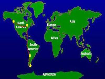 |
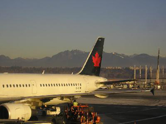
| I began my trip in Vancouver (Canada). One starts to see mountains immediately in the Vancouver International Airport. | | My destination was Punta Arenas (Chile), the southmost city in South America, which is a starting point for Mt. Vinson trip. It took 36 hours of flight with two stops (in Toronto and Santiago) to get to Punta Arenas. |
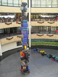 | |  |
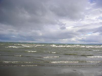
| In 24 hours I was in Santiago airport. This is how they storage your luggage. | | I had seven hours before my next flight, and I decided to take a bus to see the city.
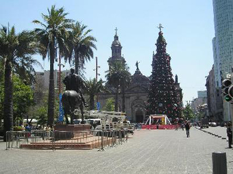
The temperature in Santiago was + 30° C. Keeping in mind that later I faced – 40° C in Antarctica, the total temperature range in this short trip was 70° C. It was Christmas time, and Christmas trees decorated the city along with palms. |
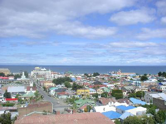 | |  |
| Finally I landed at Punta Arenas (Chili), a small city at the very south of South America. It supposed that I would stay one day there shopping for food for the expedition. However, because of very bad weather in Antarctica, no flights were possible. The flight was postponed for three hours, then for four, for three again, and again. I was tied to the hotel, and just waited, exploring the city around. I knew that in the worst case the weather prevented the flight to Antarctica for fourteen days. So, it wasn’t too bad that I spend four days in Punta Arenas waiting for the flight. | | Punta Arenas is located on the shore of the Strait of Magellan, which connect the Atlantic Ocean and the Pacific Ocean. That means that if you swim there, you swim in both oceans at once. |
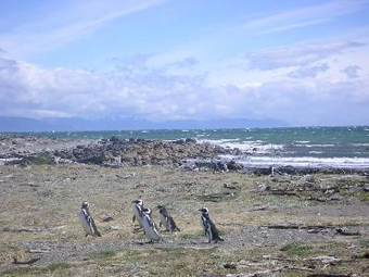 | |  |
Local residents: penguins. There are seventeen different species of penguins in the world. Only one kind inhabits in the south of Chili: Magellanic Spheniscus magellanicus.
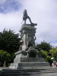
There was no way I could meet penguins in Antarctica- they live in a seashore, not in the mountains. | | A statue of Magellan decorates the main square of Punta Arenas. On the bottom of the statue there are several figures, including a figure of an Indian |
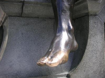 | | 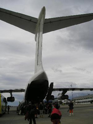 |
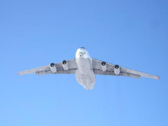
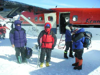
| A foot of the Indian in the Magellan statue shines brightly in the daylight. A legend said that if one kiss the foot, he will be back safely from his trip. I kissed it, and now can confirm that it works. | | Finally the weather improved and I got to a Russian military transportation aircraft “Illushin” to fly to Antarctica. |
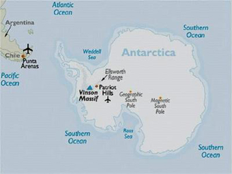 | | 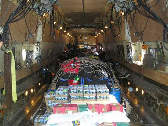 |
| To climb Vinson Massif one has to fly from Punta Arenas to Patriot Hills camp in Antarctica (the distance is about 2,000 km), and then fly another hour by a small plane to the base of the mountain. | | A flight to Patriot Hills usually takes 5-6 hours. Inside the plane a view was not so pleasant. A hundred of barrels with fuel covered the floor along the plane. Backpacks and other luggage were stored on the barrels. Not very many people (seen on the back) headed to the continent the same time as I did. |
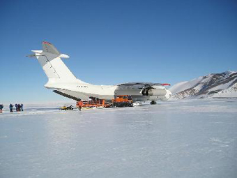 | | 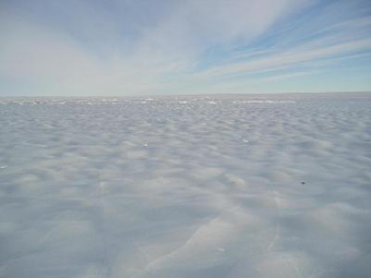 |
| Five hours later the plane landed in Antarctica. | | The ‘airdrome’ at Patriot Hills: blue ice.
Landing at Patriot Hills is always exciting, because the runway is just a blue ice, and it is impossible for the plane to apply brakes. I knew that on the previous flight the plane rotated 3 times around its axis while landing. |
 | |  |
Two hours later Russian pilots played their farewell trick by flying 30 meters above the camp, and the plane flew to civilization. I was aware that it will be back in seven days, and if I would not be on Patriot Hills seven days later, I would stay on the continent for another some 14 days.
The climb of Vinson Massif usually takes 14+ days. For instance, the previous group of climbers spends 18 days on the continent.
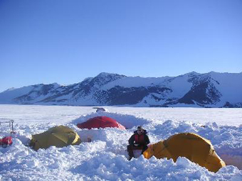
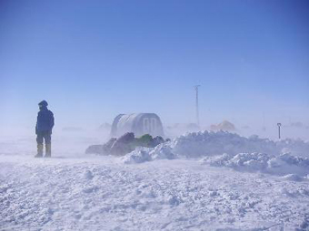
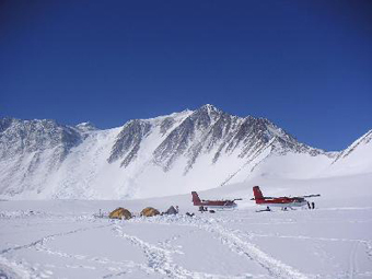
So, I tried to do my best to be back in time and was lucky enough to succeed in that. | | There is nothing permanent in the Patriot Hills camp. It is located about 1800 miles from the nearest city. In a season you will find few tents there. The Hills partly protect camp from a strong wind, however a good practice is to dig into the snow as far as possible. |
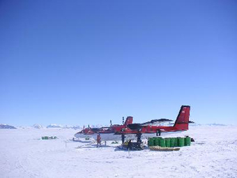 | |  |
| I had to fly another hour to the base camp of Mt. Vinson by one of these small planes. | | However, next morning strong wind at Patriot Hills prevented the flight.
Extremely strong winds are one of the dangers in Mt. Vinson and Antarctica. The atmospheric pressure at the South Pole is low, and air masses are being sucked into the regions at high altitudes. |
 | | 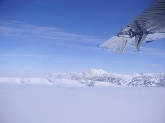 |
| By the evening the weather improved for several hours. The flight was possible now. | | Antarctica lied under the wing of the plane. |
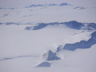 | | 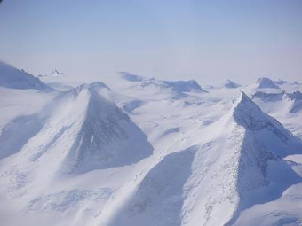 |
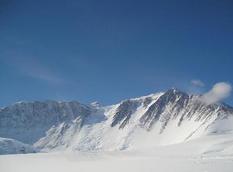
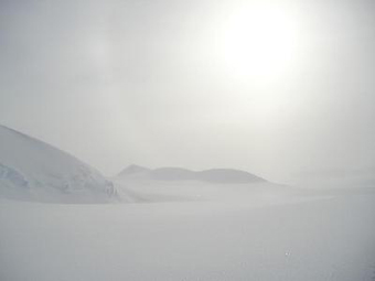
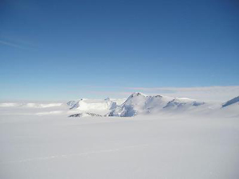
| One to three kilometer layer of ice almost completely covers the continent. Only some mountains are above that icy surface. | | Beautiful mountains were never climbed. |
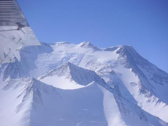 | |  |
| Vinson Massif was now under the wing. | | The planes landed at the base of Vinson Massif. |
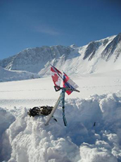 | | 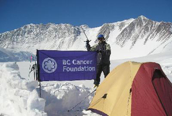 |
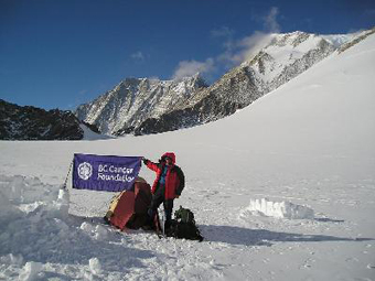
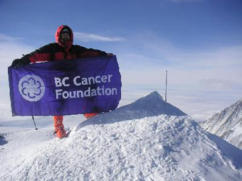
| At the base camp. | | The main goal of this climb was to raise funds for cancer research and care with the BC Cancer Foundation. Near my tent I made several pictures with the BC Cancer Foundation flag. Vinson Massif is on the background. |
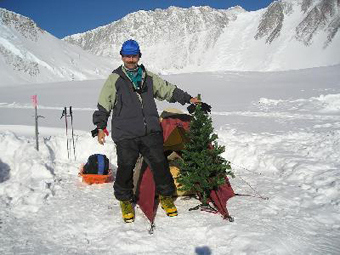 | |  |
What a Christmas without a Christmas tree?
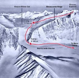
Of course it was an artificial one. No trees, grass, birds, insects, or animals are available in this area. Completely dead zone. | | This picture, taken from the Internet, illustrates the route. From the base camp I climbed to the altitude 3,100 m. and established my Camp1 there. The distance was about 12 km with the elevation gained about 1,000 m. It took about 5.5 hours for me plus one hour, which I spend at 2,700 m. melting snow to drink.
From the Camp 1 I climb the Head Wall to the Col between Mt. Shinn and Mt. Vinson. I established my High Camp on the Col at about 3,900 m. (5 km distance).
From the High Camp the route follows Branscomb Ridge to the summit (7 km distance, 1,000 m. elevation). |
 | |  |
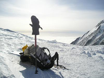
| Next morning after flying to the base camp I was ready to move to the Camp1. I had about 45 kg to carry. I didn’t know how long I would climb the mountain. It all depended on the weather. So, I wanted to make my Camp 1 to be an advanced base camp with food, fuel and equipment enough for a long climb. | | The weather was reasonable. The sun in Antarctica gives light, but not very much heat. In daytime it is not so bad, but at night, when sun is behind the mountains it is getting extremely cold. My new boots were rated up to – 50° C. When I moved, it was warm enough. However, sometimes when I stayed in the evening near my tent for 10 minutes I felt like I am wearing home slippers, not the mountaineering boots. |
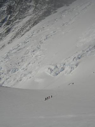 | |  |
Small people, big mountain.
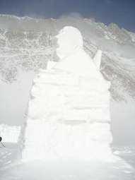
I took this picture while melting snow in the middle of my way to Camp 1. Group of climbers is approaching slopes of Vinson. | | Now I am very close to Camp 1. This is a snow statue of Mr. C. Vinson made by a previous group of climbers, who were trapped in the camp by bad weather for five days. |
 | |  |
| My camp 1. | | The Head wall (elevation of the wall is about 600 m.). The steepness is up to 40°. I climbed the wall for acclimatization next day after arrival to Camp 1. |
 | |  |
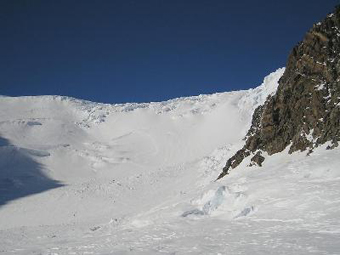
The upper part of the Head wall is a huge field of seracs. The ice is as solid as a bottle glass. The crampons left very little tracks on it.
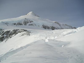
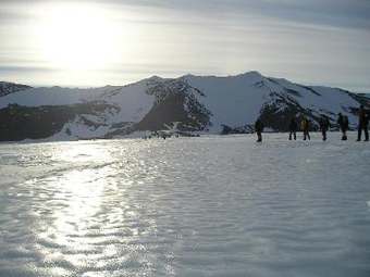
One have to choose the way carefully. Seracs are not stable constructions and sometimes fall down. Last year fallen serac buried two climbers somewhere here. | | In several hours I reached the col.
You can see Mt. Shinn on the background. That is the third highest mountain in Antarctica, only 200 meters smaller than Mt. Vinson.
By the time I get there the weather became worth, with a strong wind. I made a cache with my load in one of the crevasses, and headed down to Camp 1. |
 | | 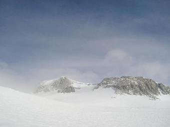 |
| Next day I climbed to the High camp. | | On a summit day I wanted to start in the morning, but low temperature (below –30°C) along with extremely strong wind made a possibility for frostbites too high. I postponed the start till the wind slow down a bit, and began the climb only at 5 p.m. Daylight is 24 hours in Antarctica in December, and it gives you much more flexibility.
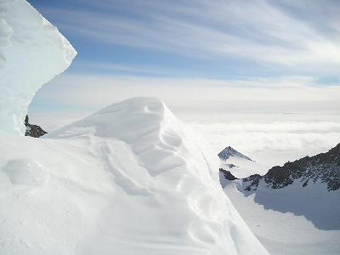
A summit ridge of Mt. Vinson is on the picture. However it is still 500 m. elevation to gain. |
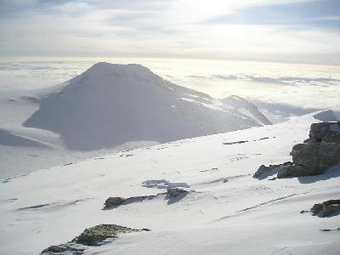 | | 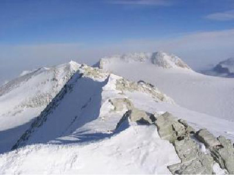 |
| Now I am very high on the mountain. Almost everything is below me. | | The summit ridge. Last meters to the summit. |
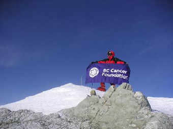 | |  |
| After 6 hours from the start I reached the summit of Vinson Massif. | | On the top of Antarctica with the BC Cancer Foundation. |
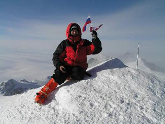 | |  |
| On the summit of Vinson Massif (4,897 m.). | | Next day I made all the way back to the base camp.
I have climbed it! |
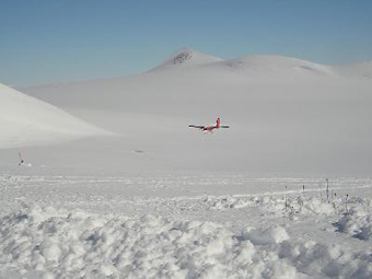 | |  |
| Small plane is landing again to the base camp of Mt. Vinson. | | Last views of the beautiful continent. |
 | | 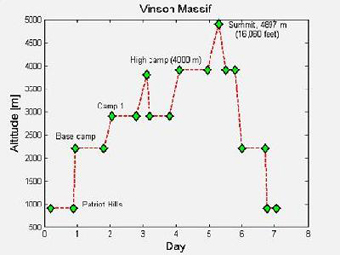 |
| I have returned to the blue ice of Patriot Hills airdrome. The big plane is ready to fly. | | The final schedule of my climb. I spend exactly seven days in Antarctica, very remote, cold, and beautiful continent. |